Explore GIS Day with ArcGIS Mapping and SPARKvue
Celebrate GIS Day by exploring GIS technology and its many real-world applications.
November 18, 2020 is international GIS Day! Started in 1999 by Esri president and co-founder, Jack Dangermond, GIS Day has since grown into a worldwide celebration of geographic information system technology. Today, thousands of schools, colleges, government agencies, non-profits, and professionals come together every GIS Day to share how their work is impacting society.
There are tons of freely accessible GIS Day resources, many of which are designed to teach students about GIS technology, its role in their community and the industries utilizing it to make sense of the world around us. Because GIS has so many diverse applications, there are tons of ways to include it in your science course. You can collect local weather data, utilize existing public data, such as ArcGIS’s Living Atlas, or even attend a virtual GIS Day event.
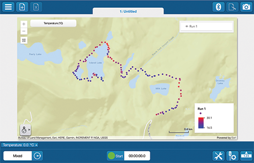
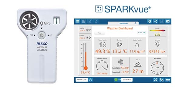
The PASCO team is celebrating GIS Day with our favorite tool for environmental monitoring – the Wireless Weather Sensor with GPS. This all-in-one instrument measures up to 19 environmental parameters and includes a specialized, ESRI ArcGIS display map within SPARKvue. Plus, it’s cross-platform, so you can track data from your computer, or bring your phone or tablet into the field to enjoy the same user experience wherever your investigation takes you.